
First Tropical Storm of 2026 Could Form Next Week in USA
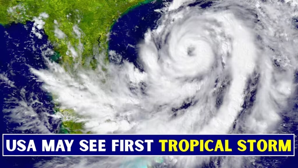
First Tropical Storm a large area of moisture near the Gulf Coast may produce the first tropical threat of the 2026 Atlantic hurricane season. None of the official forecasters have confirmed any named storms but early season weather patterns can change quickly. June is here and residents should watch closely.

Why Are Forecasters Watching the Gulf?
Warm water, humid air and weak low-pressure areas can combine to get the Gulf region going early in hurricane season. Even if the wind conditions are not right for storm development, the deep tropical moisture can still produce dangerous rain, flooding and rough coastal weather in parts of the southern U.S.

- Tropical development can occur over warm Gulf waters.
- Moisture could increase showers and thunderstorms.
- Low pressure may try to organise slowly.
- Flooding could be the biggest threat.
Could it develop into Tropical Storm Arthur?
If a tropical system were to develop and reach sustained winds of 39 mph, it would be the first named storm of the 2026 Atlantic season. Arthur is the first name on the list. But even if it never becomes a named tropical storm, a system can still bring heavy rain and coastal impacts.
 Delhi NCR Rain Date Confirmed as IMD Predicts Heavy Showers and Relief From Heatwave Conditions
Which US States to Watch Closely?
Areas along the Gulf Coast, especially locations from Texas through Louisiana, Mississippi, Alabama and Florida should be watching the forecast most carefully. Some moisture could also push towards the South-east depending on the track of the system. The exact track remains uncertain, so look for local forecasts.

- Texas Coast
- Louisiana and Mississippi
- Alabama beaches
Florida Gulf Coast Parts of Southeast What Effects Are Anticipated Next Week?
It’s possible the heavy rain is more of a worry than the strong winds. With tropical moisture, repeated thunderstorms may form over the same areas, increasing the risk of flash flooding. The showers could also produce rough surf, gusty winds and minor travel disruptions if they develop better organisation near land.
- Short bursts of heavy showers
- Flash flood, localised
- Gusty thunderstorms
- Rough surf near beaches.
Why early June?
The Atlantic hurricane season officially begins on June 1 and ends on Nov. 30. Storms in early June are not the most common, but they do happen, especially near the Gulf of Mexico, western Caribbean and South-east coast. These regions can develop systems that form rapidly close to land.
What strength could the system have?
As of now, a major hurricane doesn’t seem to be the main concern. The wind shear may preclude strong development but a weak tropical depression or low-end tropical storm can not be ruled out. Early season systems tend to be messy, rain-laden and difficult to predict several days in advance.
So What Should Residents Do?
Those along the Gulf Coast should use this early warning to review hurricane plans. Preparation is not panic. It means staying informed on the latest information and checking emergency supplies, and knowing what to do if local officials issue watches, warnings or flood alerts.
- Follow updates from the National Hurricane Centre
- Know local weather alerts daily.
- Have flashlights, water, batteries.
- Clear drains at your home.
- Don’t drive through flooded roads.
Why Are Early Storms Difficult to Predict?
Early tropical systems are often broad and disorganised areas of moisture, rather than a well-defined centre of a storm. This reduces the consistency of the computer models. A small change in wind shear, water temperature or the location of a low pressure area can mean the difference between the disturbance dying out, becoming a rainmaker, or slowly earning a tropical name.
No development is expected but an area of interest could develop into the first tropical storm of 2026 next week. The more immediate threat is heavy rain and localised flooding along the Gulf Coast. Local residents should be weather-aware, but not take the early speculation as a sure-fire storm forecast.